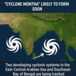
India’s weather authorities are closely monitoring two developing cyclonic systems — one over the East-Central Arabian Sea and another over the Southeast Bay of Bengal — that are expected to intensify over the next 48 hours. The system forming over the Bay of Bengal is likely to be named Cyclone Montha once it reaches the cyclonic storm stage.
Current Situation
According to the India Meteorological Department (IMD), both low-pressure zones have shown significant organization since early Sunday morning. The Arabian Sea system is gradually intensifying and may move north-northeastward, while the Bay of Bengal disturbance is gaining strength under favorable sea surface temperatures and wind patterns.
IMD officials reported that Cyclone Montha is expected to become a deep depression by Monday and could strengthen into a cyclonic storm by Tuesday. Preliminary models suggest a possible trajectory toward the Andhra Pradesh–Odisha coast, though exact landfall predictions will be made once the system consolidates further.
Preparedness Measures
The National Disaster Response Force (NDRF) and Indian Navy have been placed on high alert across coastal states, including Tamil Nadu, Andhra Pradesh, Odisha, Kerala, and Gujarat.
Fishermen have been advised not to venture into the open sea due to rough weather and strong winds likely to reach 50–70 km/h in some regions.
State governments have begun taking precautionary steps such as:
Setting up temporary shelters in vulnerable coastal districts
Stocking emergency relief materials
Issuing early warnings through local administrative units
Meteorological Analysis
Experts suggest that this rare twin-system formation may temporarily influence each other’s movement — a meteorological phenomenon known as the Fujiwhara effect, where two cyclones rotate around a common center.
However, the IMD clarified that both systems are currently too far apart to cause direct interaction.
Dr. M. Mohapatra, Director-General of IMD, stated:
“The Bay of Bengal system shows strong signs of intensification. Once sustained winds reach 62 km/h or above, it will be officially classified and named Cyclone Montha.”
Potential Impact
Heavy rainfall, thunderstorms, and gusty winds are forecast for coastal Odisha, Andhra Pradesh, and southern Tamil Nadu beginning October 28.
In the Arabian Sea, parts of Konkan, Goa, and Kerala may experience intermittent rain and high waves.
Authorities have warned of possible localized flooding and crop damage in low-lying areas if the systems continue to strengthen.
Outlook
Meteorologists emphasize the importance of continuous updates, as twin cyclonic formations are uncommon in October, a period that generally marks the post-monsoon transition.
With Cyclone Montha developing rapidly, the coming week will be crucial for monitoring its path and potential landfall zone.
Related posts:

AI-powered cybercrime is rising fast in India, endangering its $5-trillion economic goal. Learn how innovation and security must go hand in hand.

Discover trusted wedding venues and verified vendors on WeddSmart.com. Plan smarter, compare options, and create unforgettable celebrations with ease.
 AI-Driven Cybercrime Threatens India’s $5-Trillion Dream
 How to Find the Perfect Wedding or Event Venues & Vendors on WeddSmart.com
 China and U.S. Reach Preliminary Consensus in Kuala Lumpur Trade Talks
 Twin Cyclones Brewing Over Indian Seas: “Cyclone Montha” Likely to Form Soon
 Brazilian Vice President Arrives in India for Three-Day Official Visit